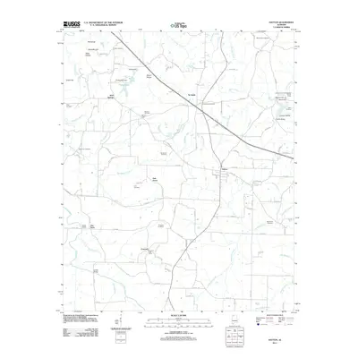
2011 Map of Hatton
USGS Topo · Published 2011About this map
Hatton and its surrounding communities in Lawrence County are defined by a complex network of creeks and family landmarks. The landscape is dotted with ancestral burial grounds, including Roden Cemetery near the northern border and Love Cemetery further south. These sites, along with the Concord Post Office and the Lawrence County Association Church Camp, reflect a deeply rooted rural society structured around small settlements like Wolf Springs and Beavers Cross.
Find a feature on this map
112 named features on this map. Tap any name to fly to it.
Don’t see what you’re looking for? This feature index may not catch every label — zoom into the map to look around manually.
Map Details
Editions of this 2011 Hatton Map
This is the sole edition of this map. No revisions or reprints were ever made.
Other maps of this area

1924 · Tuscumbia
USGS Topo · 1:48,000

1926 · Tuscumbia
USGS Topo · 1:62,500

1935 · Moulton
USGS Topo · 1:24,000

1936 · Newburg
USGS Topo · 1:24,000

1936 · Courtland
USGS Topo · 1:24,000

1936 · Moulton
USGS Topo · 1:48,000

1936 · Town Creek
USGS Topo · 1:24,000
1936 · Leighton
USGS Topo · 1:24,000

1936 · Masterson
USGS Topo · 1:24,000

1936 · Hatton
USGS Topo · 1:24,000