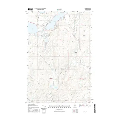
2015 Map of Hauer
USGS Topo · Published 2015About this map
Reserve and Hauer anchor this northern Wisconsin landscape, where the Couderay River system meets an intricate network of glacial lakes and wetlands. The settlement of Reserve sits just east of the Billy Boy Flowage, a significant water feature that connects several drainages including Summit Cr and Sugette Cr. The terrain is defined by its water bodies, ranging from the large expanse of Whitefish Lake to smaller, distinct basins like Hungry Lake, Ham Lake, and Pearce Lake.
Find a feature on this map
72 named features on this map. Tap any name to fly to it.
Don’t see what you’re looking for? This feature index may not catch every label — zoom into the map to look around manually.
Map Details
Editions of this 2015 Hauer Map
This is the sole edition of this map. No revisions or reprints were ever made.
Other maps of this area

1944 · Couderay
USGS Topo · 1:48,000

1945 · Meteor
USGS Topo · 1:48,000

1948 · Couderay
USGS Topo · 1:48,000

1948 · Stone Lake
USGS Topo · 1:48,000

1949 · Meteor
USGS Topo · 1:48,000

1949 · Rice Lake
USGS Topo · 1:48,000

1950 · Stone Lake
USGS Topo · 1:48,000

1951 · Rice Lake
USGS Topo · 1:48,000

1953 · Rice Lake
USGS Topo · 1:250,000

1959 · Rice Lake
USGS Topo · 1:250,000