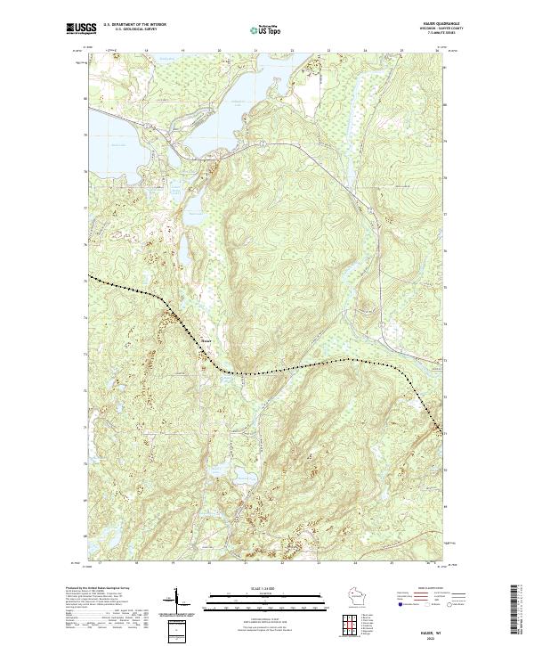
2022 Map of Hauer
USGS Topo · Published 2022About this map
The settlement of Hauer lies at the heart of this Sawyer County landscape, situated amidst a dense network of glacial lakes and northern waterways. Fed by Lower Hauer Spring, the Hauer Cr meanders toward the Couderay River, which winds through the eastern portion of the survey. The terrain is defined by its numerous named basins, ranging from the expansive Whitefish Lake and Sand Lake in the northwest to smaller water bodies like Pearce Lake, Ham Lake, and Rogers Lake.
Find a feature on this map
62 named features on this map. Tap any name to fly to it.
Don’t see what you’re looking for? This feature index may not catch every label — zoom into the map to look around manually.
Map Details
Editions of this 2022 Hauer Map
This is the sole edition of this map. No revisions or reprints were ever made.
Other maps of this area

1944 · Couderay
USGS Topo · 1:48,000

1945 · Meteor
USGS Topo · 1:48,000

1948 · Couderay
USGS Topo · 1:48,000

1948 · Stone Lake
USGS Topo · 1:48,000

1949 · Meteor
USGS Topo · 1:48,000

1949 · Rice Lake
USGS Topo · 1:48,000

1950 · Stone Lake
USGS Topo · 1:48,000

1951 · Rice Lake
USGS Topo · 1:48,000

1953 · Rice Lake
USGS Topo · 1:250,000

1959 · Rice Lake
USGS Topo · 1:250,000