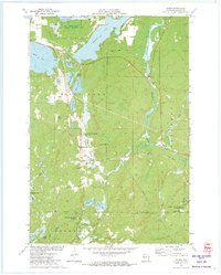
1971 Map of Hauer
USGS Topo · Published 1973About this map
The Lac Courte Oreilles Indian Reservation Boundary defines much of this Northwoods landscape, where water and conservation land predominate. The small settlement of Hauer sits at the center of a dense network of lakes and springs, including Whitefish Lake, Sissabagama Lake, and the sprawling Billy Boy Flowage. These waters are connected by the Couderay River and smaller tributaries like Hauer Creek and Summit Creek.
Find a feature on this map
42 named features on this map. Tap any name to fly to it.
Don’t see what you’re looking for? This feature index may not catch every label — zoom into the map to look around manually.
Map Details
Editions of this 1971 Hauer Map
This is the sole edition of this map. No revisions or reprints were ever made.
Other maps of this area

1944 · Couderay
USGS Topo · 1:48,000

1945 · Meteor
USGS Topo · 1:48,000

1948 · Couderay
USGS Topo · 1:48,000

1948 · Stone Lake
USGS Topo · 1:48,000

1949 · Meteor
USGS Topo · 1:48,000

1949 · Rice Lake
USGS Topo · 1:48,000

1950 · Stone Lake
USGS Topo · 1:48,000

1951 · Rice Lake
USGS Topo · 1:48,000

1953 · Rice Lake
USGS Topo · 1:250,000

1959 · Rice Lake
USGS Topo · 1:250,000