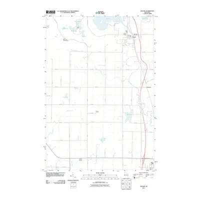
2010 Map of Haugen
USGS Topo · Published 2010About this map
Haugen serves as the primary settlement in this corner of Barron County, located where Bear Creek flows south from Bear Lake. The landscape is a complex network of glacial water bodies and small-scale water management, evidenced by the Bear Lake WP11 Dam and the Little Bear Creek 2WP1842 Dam. Rural life is anchored by several long-standing local landmarks, including the Bohemian National Cemetery near the town center and the Stanfold Lutheran Cemetery to the south along Engle Creek. The grid of county roads and avenues connects the village to smaller locales like Tuscobia and the northern reaches of Rice Lake. To the northwest, the recreational and social character of the area is highlighted by Camp Phillips on the shores of Mitchell Lake, while the central terrain is marked by smaller water features such as Mud Lake and Lake Desair.
Find a feature on this map
54 named features on this map. Tap any name to fly to it.
Don’t see what you’re looking for? This feature index may not catch every label — zoom into the map to look around manually.
Map Details
Editions of this 2010 Haugen Map
This is the sole edition of this map. No revisions or reprints were ever made.
Other maps of this area

1949 · Rice Lake
USGS Topo · 1:48,000

1951 · Shell Lake
USGS Topo · 1:48,000

1951 · Rice Lake
USGS Topo · 1:48,000

1951 · Chetek
USGS Topo · 1:62,500

1951 · Barron
USGS Topo · 1:62,500

1953 · Rice Lake
USGS Topo · 1:250,000

1959 · Rice Lake
USGS Topo · 1:250,000

1965 · Rice Lake
USGS Topo · 1:62,500

1965 · Shell Lake
USGS Topo · 1:62,500
1978 · Poskin
USGS Topo · 1:24,000