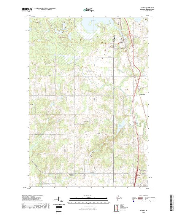
2022 Map of Haugen
USGS Topo · Published 2022About this map
Haugen sits at the northern edge of this Barron County landscape, positioned along the Wild Rivers State Trl and the shores of Bear Lake. The area's heritage is preserved through distinct landmarks such as the Bohemian National Cem and Holy Trinity church, reflecting the cultural fabric of these rural Wisconsin townships. To the south, the terrain descends toward the northern outskirts of Rice Lake, where Engle Cr and the Stanfold Lutheran Cem mark the transition into more developed surroundings.
Find a feature on this map
73 named features on this map. Tap any name to fly to it.
Don’t see what you’re looking for? This feature index may not catch every label — zoom into the map to look around manually.
Map Details
Editions of this 2022 Haugen Map
This is the sole edition of this map. No revisions or reprints were ever made.
Other maps of this area

1949 · Rice Lake
USGS Topo · 1:48,000

1951 · Shell Lake
USGS Topo · 1:48,000

1951 · Rice Lake
USGS Topo · 1:48,000

1951 · Chetek
USGS Topo · 1:62,500

1951 · Barron
USGS Topo · 1:62,500

1953 · Rice Lake
USGS Topo · 1:250,000

1959 · Rice Lake
USGS Topo · 1:250,000

1965 · Rice Lake
USGS Topo · 1:62,500

1965 · Shell Lake
USGS Topo · 1:62,500
1978 · Poskin
USGS Topo · 1:24,000