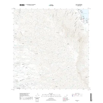
2017 Map of Hauula
USGS Topo · Published 2017About this map
Hauula and the coastal fringes of O'ahu meet the steep fluted ridges of the Ko'olau Range in this detailed topographic study. The landscape is defined by an extensive system of water management infrastructure, where several mountain-piercing conduits such as the Poamoho Tunnel and Waiāhole Ditch Tunnel traverse the central heights. On the windward side, settlements and sandy stretches like Kokololio Beach and Kapalaoa Beach sit at the base of deep-cut drainages including Koloa Gulch and Ma'akua Gulch. To the west, the plateau surrounding Wahiawa shows a dense street grid featuring Whitmore Ave and California Ave adjacent to the Wahiawa Reservoir. This 2017 survey illustrates the complex relationship between the residential areas on the plains and the rugged, stream-carved interior where the Helemano Stream and Poamoho Stream originate.
Find a feature on this map
89 named features on this map. Tap any name to fly to it.
Don’t see what you’re looking for? This feature index may not catch every label — zoom into the map to look around manually.
Map Details
Editions of this 2017 Hauula Map
This is the sole edition of this map. No revisions or reprints were ever made.
Other maps of this area

1952 · Waimea
USGS Topo · 1:24,000

1953 · Haleiwa
USGS Topo · 1:24,000

1953 · Schofield Barracks
USGS Topo · 1:24,000

1953 · Hauula
USGS Topo · 1:24,000

1954 · Oahu
USGS Topo · 1:250,000

1954 · Kahuku
USGS Topo · 1:24,000

1954 · Kahana
USGS Topo · 1:24,000

1954 · Kaneohe
USGS Topo · 1:24,000

1954 · Waipahu
USGS Topo · 1:24,000

1959 · Kaneohe
USGS Topo · 1:24,000