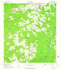
1963 Map of Havana South
USGS Topo · Published 1964About this map
The Seaboard Air Line railroad corridor serves as the primary industrial axis for this Gadsden County landscape in the early 1960s, connecting the established community of Havana with smaller settlements like Scotland, Gibson, and Midway. The tobacco-growing heritage of the region is evident in the dense network of small structures and clearings surrounding rural congregational centers such as China Hill Ch and Nash Temple. Along the eastern edge, the Ochlockonee River forms a natural boundary with Leon County, its floodplain punctuated by Pine Bluff and the modern footprint of the Tallahassee Commercial Airport. This period reveals a landscape transitioning from traditional agriculture to a more connected regional economy, where infrastructure like the Lookout Tower and Gaging Station monitor the vast network of creek branches, including Hurricane Creek and Double Branch, that drain into the river valley.
Find a feature on this map
38 named features on this map. Tap any name to fly to it.
Don’t see what you’re looking for? This feature index may not catch every label — zoom into the map to look around manually.
Map Details
Editions of this 1963 Havana South Map
This is the sole edition of this map. No revisions or reprints were ever made.
Other maps of this area

1940 · Tallahassee
USGS Topo · 1:62,500

1942 · Tallahassee
USGS Topo · 1:62,500

1943 · Tallahassee
USGS Topo · 1:62,500

1943 · Lake Talquin
USGS Topo · 1:62,500

1954 · Tallahassee
USGS Topo · 1:250,000

1956 · Havana North
USGS Topo · 1:24,000

1956 · Dogtown
USGS Topo · 1:24,000

1956 · Calvary
USGS Topo · 1:24,000

1959 · Tallahassee
USGS Topo · 1:250,000

1959 · Quincy
USGS Topo · 1:24,000