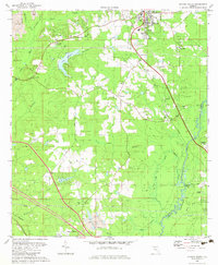
1982 Map of Havana South
USGS Topo · Published 1983About this map
Havana serves as the primary northern anchor on this 1980s landscape, where the Seaboard railroad cuts a diagonal path toward the southeast near Gibson and Midway. The terrain is defined by a dense network of tributaries including Hurricane Creek, Double Branch, and Reed Creek, which all feed toward the winding Ochlockonee River at the Leon County border. This era shows a mix of traditional rural infrastructure and modern development, evidenced by the presence of the Tallahassee Commercial Airport and several residential trailer parks.
Find a feature on this map
49 named features on this map. Tap any name to fly to it.
Don’t see what you’re looking for? This feature index may not catch every label — zoom into the map to look around manually.
Map Details
Editions of this 1982 Havana South Map
This is the sole edition of this map. No revisions or reprints were ever made.
Other maps of this area

1940 · Tallahassee
USGS Topo · 1:62,500

1942 · Tallahassee
USGS Topo · 1:62,500

1943 · Tallahassee
USGS Topo · 1:62,500

1943 · Lake Talquin
USGS Topo · 1:62,500

1954 · Tallahassee
USGS Topo · 1:250,000

1956 · Havana North
USGS Topo · 1:24,000

1956 · Dogtown
USGS Topo · 1:24,000

1956 · Calvary
USGS Topo · 1:24,000

1959 · Tallahassee
USGS Topo · 1:250,000

1959 · Quincy
USGS Topo · 1:24,000