1949 Map of Havelock
USGS Topo · Published 1984About this map
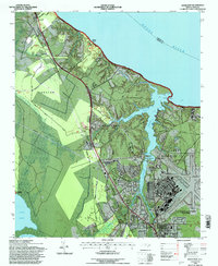
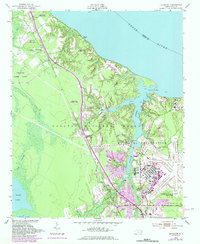
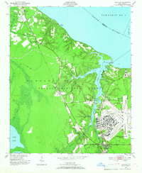
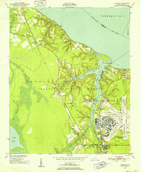
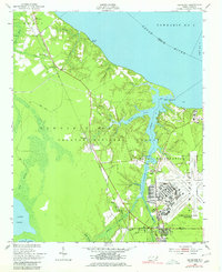
The U S Marine Corps Air Station Cherry Point dominates the landscape along the Slocum Creek estuary, showing the significant military footprint that shaped this region of North Carolina by the mid-20th century. While the air station occupies the eastern bank, the western side of the creek is defined by the dense woodlands of the Croatan National Forest and the Croatan Game Land. Small settlements like Pine Grove and Croatan are linked by the Atlantic and East Carolina railroad, which runs parallel to the highway toward the coastal waters of the Neuse River. Cultural markers of the era include the Brice Creek Ch near the northern boundary and a Drive-in Theater just outside the military reservation, reflecting the social life of the post-war community. The map also captures the transition of Havelock from a railroad stop to a vital service hub for the nearby naval and marine facilities.
Find a feature on this map
40 named features on this map. Tap any name to fly to it.
Don’t see what you’re looking for? This feature index may not catch every label — zoom into the map to look around manually.
Map Details
Editions of this 1949 Havelock Map
4 editions found
Historical Maps of New Bern Through Time
7 maps found