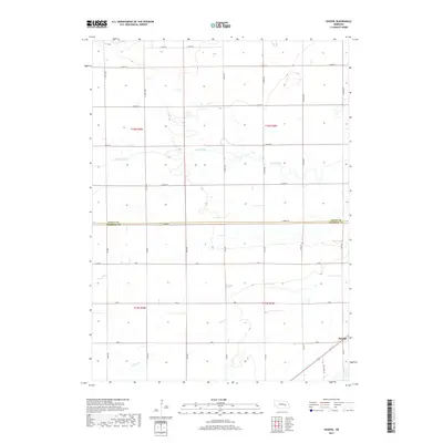
2017 Map of Havens
USGS Topo · Published 2017About this map
The small settlement of Havens anchors the southeastern corner of this rural landscape where the agricultural grids of t15n r4w and t16n r4w meet. The terrain is defined by the winding paths of Prairie Creek and Silver Cr, which cut through a landscape of section lines and gravel roads. Located at the intersection of Merrick Co and Nance Co, the area shows a highly organized township and range system where names like Half Mile Rd and S 350th Ave represent the vital transport network for the region's farming heritage. The map documents the persistent layout of these rural communities, illustrating how watercourses like Prairie Creek influenced the placement of roads and property boundaries across the Nebraska plains.
Find a feature on this map
31 named features on this map. Tap any name to fly to it.
Don’t see what you’re looking for? This feature index may not catch every label — zoom into the map to look around manually.
Map Details
Editions of this 2017 Havens Map
This is the sole edition of this map. No revisions or reprints were ever made.
Other maps of this area

1896 · Stromsburg
USGS Topo · 1:125,000

1955 · Fremont
USGS Topo · 1:250,000

1957 · Fremont
USGS Topo · 1:250,000

1958 · Fremont
USGS Topo · 1:250,000

1958 · Genoa
USGS Topo · 1:24,000
1958 · Merchiston
USGS Topo · 1:24,000

1958 · Fullerton
USGS Topo · 1:24,000

1958 · Fullerton NE
USGS Topo · 1:24,000

1958 · Silver Creek
USGS Topo · 1:24,000

1958 · Havens
USGS Topo · 1:24,000