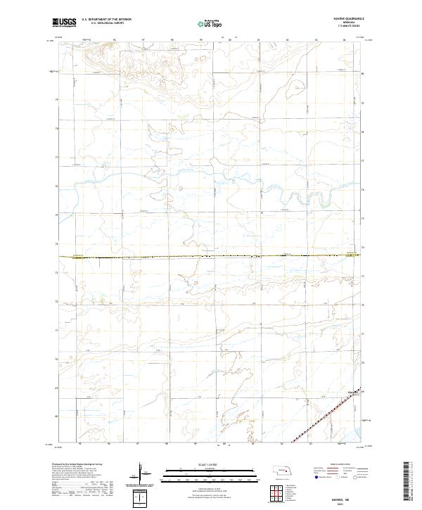
2021 Map of Havens
USGS Topo · Published 2021About this map
Havens occupies a quiet corner of the central Nebraska plains, situated along the border of Nance Co Merrick Co. The landscape is defined by the parallel paths of Prairie Creek and Silver Cr, which cut through the strictly ordered grid of section lines and gravel roads. This area reflects the late twentieth and early twenty-first-century agricultural character of the region, where a dense network of local routes like Half Mile Rd, X RD, and S 320th Ave serves scattered farmsteads and cultivated fields. The map captures the interface between the natural drainage of the Platte River valley's tributaries and the rectilinear precision of the Public Land Survey System, illustrating how water and roads have shaped the development of this rural community over time.
Find a feature on this map
32 named features on this map. Tap any name to fly to it.
Don’t see what you’re looking for? This feature index may not catch every label — zoom into the map to look around manually.
Map Details
Editions of this 2021 Havens Map
This is the sole edition of this map. No revisions or reprints were ever made.
Other maps of this area

1896 · Stromsburg
USGS Topo · 1:125,000

1955 · Fremont
USGS Topo · 1:250,000

1957 · Fremont
USGS Topo · 1:250,000

1958 · Fremont
USGS Topo · 1:250,000

1958 · Genoa
USGS Topo · 1:24,000
1958 · Merchiston
USGS Topo · 1:24,000

1958 · Fullerton
USGS Topo · 1:24,000

1958 · Fullerton NE
USGS Topo · 1:24,000

1958 · Silver Creek
USGS Topo · 1:24,000

1958 · Havens
USGS Topo · 1:24,000