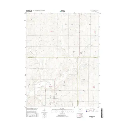
2015 Map of Havensville
USGS Topo · Published 2015About this map
Havensville and the crossroads of America City define the rural character of this northern Kansas landscape at the junction of Pottawatomie, Nemaha, and Jackson counties. The terrain is deeply etched by the drainage systems of Vermillion Cr and its tributaries, including Coal Cr and Wolf Cr. For local historians and genealogists, the map identifies several significant burial sites, such as Hawesville Cem just outside the Havensville town limits and America City Cem further north. The settlement pattern follows a grid of section-line roads, though older routes like Old Trail Rd and Homestead Rd suggest the earlier paths taken by settlers moving through the region. This 2015 survey reflects the enduring agrarian footprint established in the late 19th century, preserved here through precise topographic detail.
Find a feature on this map
39 named features on this map. Tap any name to fly to it.
Don’t see what you’re looking for? This feature index may not catch every label — zoom into the map to look around manually.
Map Details
Editions of this 2015 Havensville Map
This is the sole edition of this map. No revisions or reprints were ever made.
Other maps of this area

1888 · Hiawatha
USGS Topo · 1:125,000

1889 · Seneca
USGS Topo · 1:125,000

1889 · Wamego
USGS Topo · 1:125,000

1889 · Topeka
USGS Topo · 1:125,000

1894 · Seneca
USGS Topo · 1:125,000

1894 · Topeka
USGS Topo · 1:125,000

1894 · Hiawatha
USGS Topo · 1:125,000

1894 · Wamego
USGS Topo · 1:125,000

1950 · Kansas City
USGS Topo · 1:250,000

1954 · Kansas City
USGS Topo · 1:250,000