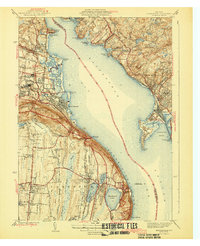
1943 Map of Haverstraw
USGS Topo · Published 1943About this map
Haverstraw Bay dominates this mid-century landscape where the Hudson River widens significantly between the shores of Rockland and Westchester counties. Along the western bank, industrial and residential life centers on the brick-making legacy and river commerce of Haverstraw, West Haverstraw, and Garnersville. The terrain rises sharply to the south toward the prominent heights of High Tor and Hook Mountain, while the riverfront at Snedeker Landing reflects the area's long-standing maritime orientation.
Find a feature on this map
90 named features on this map. Tap any name to fly to it.
Don’t see what you’re looking for? This feature index may not catch every label — zoom into the map to look around manually.
Map Details
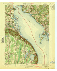
Editions of this 1943 Haverstraw Map
2 editions found
Other maps of this area

1891 · Ramapo
USGS Topo · 1:62,500

1892 · West Point
USGS Topo · 1:62,500

1892 · Tarrytown
USGS Topo · 1:62,500

1893 · Tarrytown
USGS Topo · 1:62,500

1893 · Ramapo
USGS Topo · 1:62,500

1894 · West Point
USGS Topo · 1:62,500

1899 · West Point
USGS Topo · 1:62,500

1901 · West Point
USGS Topo · 1:62,500

1902 · Tarrytown
USGS Topo · 1:62,500

1902 · Schunemunk
USGS Topo · 1:62,500