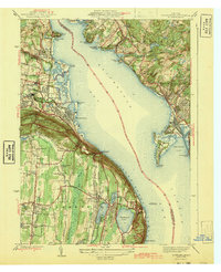
1943 Map of Haverstraw
USGS Topo · Published 1943About this map
Haverstraw Bay dominates the center of this 1938 survey, marking a significant widening of the Hudson River where industrial and maritime history converge. Along the western shore, the steep slopes of Verdrietege Hook and the Palisades Interstate Park overlook the river, while inland, the settlement of Haverstraw and the New York Reconstruction Home indicate the area's development during the early 20th century. The transportation infrastructure of the era is clearly defined, featuring the New York Central railroad and a section of the Erie (Abandoned) line.
Find a feature on this map
84 named features on this map. Tap any name to fly to it.
Don’t see what you’re looking for? This feature index may not catch every label — zoom into the map to look around manually.
Map Details
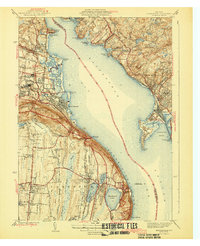
Editions of this 1943 Haverstraw Map
2 editions found
Other maps of this area

1891 · Ramapo
USGS Topo · 1:62,500

1892 · West Point
USGS Topo · 1:62,500

1892 · Tarrytown
USGS Topo · 1:62,500

1893 · Tarrytown
USGS Topo · 1:62,500

1893 · Ramapo
USGS Topo · 1:62,500

1894 · West Point
USGS Topo · 1:62,500

1899 · West Point
USGS Topo · 1:62,500

1901 · West Point
USGS Topo · 1:62,500

1902 · Tarrytown
USGS Topo · 1:62,500

1902 · Schunemunk
USGS Topo · 1:62,500