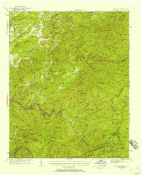
1933 Map of Haw Knob
USGS Topo · Published 1958About this map
The Tellico River winds through the heart of the southern Appalachian backcountry, documenting a landscape at the intersection of the Cherokee National Forest and Nantahala National Forest. Surveyed in the early 1930s, the map reveals a rugged mountain economy where isolated settlements like Belltown and Rafter are connected by narrow mountain roads and creek-bed trails. Local genealogy is anchored by numerous rural institutions, including Bullplay Ch, Milligan Sch, and Waucheesi Sch, many of which were central to these high-country communities. Notable landmarks like the Bald River Falls and the remote Whigg Cabin illustrate the era's transition toward protected wilderness, while river crossings like Fain Ford show how earlier travel patterns persisted. From the heights of Haw Knob to the deep drainage of Citico Creek, the map captures the Tennessee-North Carolina border before modern development altered the region.
Find a feature on this map
104 named features on this map. Tap any name to fly to it.
Don’t see what you’re looking for? This feature index may not catch every label — zoom into the map to look around manually.
Map Details
Editions of this 1933 Haw Knob Map
2 editions found
Other maps of this area

1886 · Knoxville
USGS Topo · 1:125,000

1892 · Knoxville
USGS Topo · 1:125,000

1893 · Murphy
USGS Topo · 1:125,000

1894 · Knoxville
USGS Topo · 1:125,000

1895 · Loudon
USGS Topo · 1:125,000

1895 · Knoxville
USGS Topo · 1:125,000

1901 · Knoxville
USGS Topo · 1:125,000

1914 · Murphy
USGS Topo · 1:125,000

1927 · Big Junction
USGS Topo · 1:24,000

1933 · Haw Knob
USGS Topo · 1:48,000