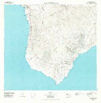
1980 Map of Hawaii County Sheet 3
USGS Topo · Published 1984About this map
The western and southern coastline of Hawaii's Big Island is defined by a succession of lava flows and deep gulches in this 1980 survey. From the historic shores of Kealakekua Bay near Napoopoo to the southern tip at Ka Lae, the map details a landscape where traditional coastal settlements like Milolii and Honaunau sit adjacent to vast preservation lands. Significant cultural landmarks are noted, including the City of Refuge Nat Historical Pk, reflecting the deep history of the South Kona and Kau districts.
Find a feature on this map
121 named features on this map. Tap any name to fly to it.
Don’t see what you’re looking for? This feature index may not catch every label — zoom into the map to look around manually.
Map Details
Editions of this 1980 Hawaii County Sheet 3 Map
This is the sole edition of this map. No revisions or reprints were ever made.
Other maps of this area

1921 · Kilauea
USGS Topo · 1:62,500

1923 · Pahala
USGS Topo · 1:62,500

1924 · Kalae
USGS Topo · 1:62,500

1924 · Kilauea
USGS Topo · 1:62,500

1924 · Honuapo
USGS Topo · 1:62,500

1927 · Kaohe
USGS Topo · 1:62,500

1928 · Kailua
USGS Topo · 1:62,500

1928 · Mauna Loa
USGS Topo · 1:62,500

1928 · Hoopuloa
USGS Topo · 1:62,500

1930 · Humuula
USGS Topo · 1:62,500