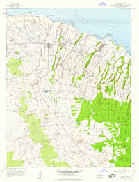
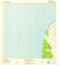
1957 Map of Hawi
USGS Topo · Published 1960About this map
Sugar production and ranching define the northern tip of the Big Island in this mid-century survey. The landscape is dominated by the industrial infrastructure of the Kohala Mill and its supporting worker communities, including Union Camp, Hoea Camp, and Halawa Camp. Civil life is concentrated along the coastal corridor at Hawi and Kapaau, where researchers will find the Kohala Hosp and Kamehameha Park.
Find a feature on this map
61 named features on this map. Tap any name to fly to it.
Don’t see what you’re looking for? This feature index may not catch every label — zoom into the map to look around manually.
Map Details
Editions of this 1957 Hawi Map
2 editions found
Other maps of this area

1913 · Kohala
USGS Topo · 1:62,500

1916 · Kohala
USGS Topo · 1:62,500

1916 · Waipio
USGS Topo · 1:62,500

1954 · Hawaii North
USGS Topo · 1:250,000

1956 · Kamuela
USGS Topo · 1:24,000

1956 · Kawaihae
USGS Topo · 1:24,000
1957 · Keawanui Bay
USGS Topo · 1:24,000
1957 · Honokane
USGS Topo · 1:24,000
1957 · Mahukona
USGS Topo · 1:24,000

1959 · Hawaii North
USGS Topo · 1:250,000