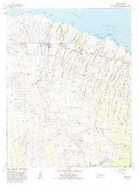
1982 Map of Hawi
USGS Topo · Published 1984About this map
The North Kohala District of Hawaii is anchored by the northernmost settlements of the Big Island, centered around Hawi and Kapaau. This 1980s landscape reflects a well-established infrastructure of ranching and early aviation, with Puakea Ranch and Kahua Ranch occupying the slopes while Upolu Airport and a coastal Lighthouse occupy the northern points. The inland terrain is characterized by numerous volcanic cones known as pu'u, such as Puu Hue and Puu o Kahua, which rise above a network of water management features including the Kehena Reservoir and several subterranean tunnels like Watt No 1 Tunnel and Bond No 2 Tunnel. This survey documents the spatial relationship between local institutions, including Kohala Schools, Kohala Hosp, and the Wainala Cemetery, alongside traditional land divisions and gulches that funnel toward the Pacific Ocean at Keawaeli Bay and Keokea Bay.
Find a feature on this map
69 named features on this map. Tap any name to fly to it.
Don’t see what you’re looking for? This feature index may not catch every label — zoom into the map to look around manually.
Map Details
Editions of this 1982 Hawi Map
2 editions found
Other maps of this area

1913 · Kohala
USGS Topo · 1:62,500

1916 · Kohala
USGS Topo · 1:62,500

1916 · Waipio
USGS Topo · 1:62,500

1954 · Hawaii North
USGS Topo · 1:250,000

1956 · Kamuela
USGS Topo · 1:24,000

1956 · Kawaihae
USGS Topo · 1:24,000
1957 · Keawanui Bay
USGS Topo · 1:24,000
1957 · Honokane
USGS Topo · 1:24,000
1957 · Mahukona
USGS Topo · 1:24,000
1957 · Hawi
USGS Topo · 1:24,000