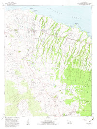
1982 Map of Hawi
USGS Topo · Published 1983About this map
Hawi and the surrounding North Kohala District landscape appear here in the early 1980s, shaped by a deep history of homesteading and ranching. The map illustrates a transition from the coastal Pacific Ocean shoreline at Upolu Pt and Kauhola Pt up into the high gulches of the Kohala Mountains. Significant local infrastructure is centered around Kapaau, including the Kohala Schools and Kohala Hosp. The settlement pattern follows a series of historic land divisions, with Upolu Homesteads, Kokoiki Homesteads, and Kahei Homesteads lining the northern coast. Large-scale agricultural operations like Puakea Ranch and Puu Hue Ranch dominate the interior, while the rugged eastern terrain is defined by a succession of deep ravines, such as Halawa Gulch and Niulii Gulch, that drop toward the sea.
Find a feature on this map
71 named features on this map. Tap any name to fly to it.
Don’t see what you’re looking for? This feature index may not catch every label — zoom into the map to look around manually.
Map Details
Editions of this 1982 Hawi Map
2 editions found
Other maps of this area

1913 · Kohala
USGS Topo · 1:62,500

1916 · Kohala
USGS Topo · 1:62,500

1916 · Waipio
USGS Topo · 1:62,500

1954 · Hawaii North
USGS Topo · 1:250,000

1956 · Kamuela
USGS Topo · 1:24,000

1956 · Kawaihae
USGS Topo · 1:24,000
1957 · Keawanui Bay
USGS Topo · 1:24,000
1957 · Honokane
USGS Topo · 1:24,000
1957 · Mahukona
USGS Topo · 1:24,000
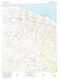
1957 · Hawi
USGS Topo · 1:24,000