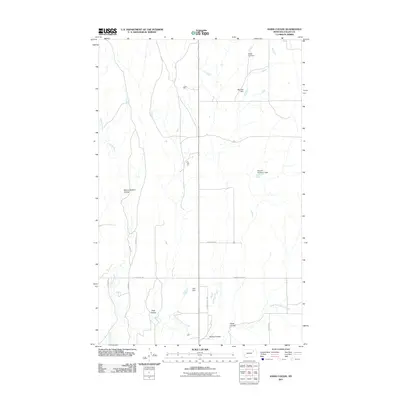
2011 Map of Hawk Coulee
USGS Topo · Published 2011About this map
Cherry Creek and its tributary, East Fork Cherry Creek, define the drainage patterns of this Valley County landscape. The distribution of small-scale water management projects, including Hawk-Eye Dam, Big Deal Dam, and Nyquist Number 1 Dam, suggests a ranching or agricultural environment reliant on seasonal water catchment. The terrain is marked by numerous erosional features such as School Section Coulee and Foss Coulee, which cut through the northern plains. A network of rural roads, including Mc Vee Rd and Johnson Rd, follows the section lines of the Public Land Survey System, providing access to remote tracts. This early 21st-century survey documents the persistent rural character of the area, where geographical identity is tied to family-named landmarks like Allie Dam and the namesake Hawk Coulee.
Find a feature on this map
18 named features on this map. Tap any name to fly to it.
Don’t see what you’re looking for? This feature index may not catch every label — zoom into the map to look around manually.
Map Details
Editions of this 2011 Hawk Coulee Map
This is the sole edition of this map. No revisions or reprints were ever made.
Other maps of this area

1914 · Nashua
USGS Topo · 1:62,500

1916 · Nashua
USGS Topo · 1:62,500

1918 · Porcupine Valley
USGS Topo · 1:62,500

1943 · Glasgow
USGS Topo · 1:125,000

1954 · Glasgow
USGS Topo · 1:250,000

1957 · Glasgow
USGS Topo · 1:250,000

1958 · Glasgow
USGS Topo · 1:250,000

1958 · Glasgow
USGS Topo · 1:24,000

1958 · Whately
USGS Topo · 1:24,000

1969 · Cornwell Reservoir
USGS Topo · 1:24,000