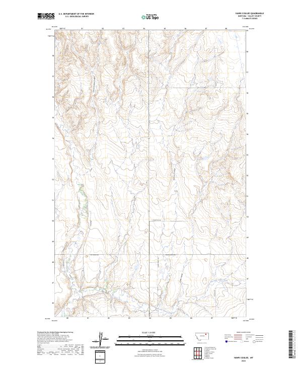
2024 Map of Hawk Coulee
USGS Topo · Published 2024About this map
Cherry Creek and its tributary, East Fork Cherry Creek, define the drainage patterns across this section of Valley County. This 2024 landscape is characterized by a network of drainage channels known as coulees, including Hawk Coulee, Spring Coulee, and Foss Coulee, which cut through the high plains. The area remains largely rural and defined by its topographic relief, with travel limited to a grid of local connectors and ranch roads such as Gilbertson Rd and Nyquist Rd. The map provides a clear look at the Public Land Survey System divisions, particularly where School Section Coulee marks traditional school sections. This modern survey reflects the enduring spatial organization of Montana’s ranching country, where land ownership and access routes like Mcvee Rd follow the contours of the coulees and the legacy of the original township surveys.
Find a feature on this map
18 named features on this map. Tap any name to fly to it.
Don’t see what you’re looking for? This feature index may not catch every label — zoom into the map to look around manually.
Map Details
Editions of this 2024 Hawk Coulee Map
This is the sole edition of this map. No revisions or reprints were ever made.
Other maps of this area

1914 · Nashua
USGS Topo · 1:62,500

1916 · Nashua
USGS Topo · 1:62,500

1918 · Porcupine Valley
USGS Topo · 1:62,500

1943 · Glasgow
USGS Topo · 1:125,000

1954 · Glasgow
USGS Topo · 1:250,000

1957 · Glasgow
USGS Topo · 1:250,000

1958 · Glasgow
USGS Topo · 1:250,000

1958 · Glasgow
USGS Topo · 1:24,000

1958 · Whately
USGS Topo · 1:24,000

1969 · Cornwell Reservoir
USGS Topo · 1:24,000