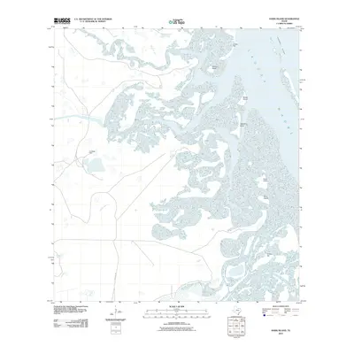
2010 Map of Hawk Island
USGS Topo · Published 2010About this map
The expansive salt flats and wetlands of the Laguna Madre dominate this coastal landscape, where a complex network of shallow water and landforms creates a distinct barrier island environment. Inland to the west, the presence of La Oveja Well points to the area's resource extraction history, while the north-south transit of the Intracoastal Waterway highlights the region's importance for maritime commerce.
Find a feature on this map
12 named features on this map. Tap any name to fly to it.
Don’t see what you’re looking for? This feature index may not catch every label — zoom into the map to look around manually.
Map Details
Editions of this 2010 Hawk Island Map
This is the sole edition of this map. No revisions or reprints were ever made.
Other maps of this area

1921 · Tarida Ranch
USGS Topo · 1:62,500

1929 · Buena Vista
USGS Topo · 1:24,000

1930 · La Leona
USGS Topo · 1:24,000

1933 · Paso Real
USGS Topo · 1:31,680

1935 · Buena Vista
USGS Topo · 1:31,680

1936 · La Leona
USGS Topo · 1:31,680

1952 · Green Island
USGS Topo · 1:24,000

1952 · South of Potrero Lopeno SE
USGS Topo · 1:24,000

1952 · Hawk Island
USGS Topo · 1:24,000

1952 · Port Mansfield
USGS Topo · 1:24,000