
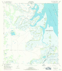
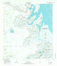
1952 Map of Hawk Island
USGS Topo · Published 1953About this map
The coastal interface of Laguna Madre and the South Texas brushland is meticulously documented in this early 1950s survey. The landscape is defined by the transition from shallow tidal flats of sand and mud to the established marshes of the Laguna Atascosa National Wildlife Refuge. This area serves as a critical hydrological junction where the Arroyo Colorado meets the lagoon, bordered by significant landmarks such as Goose Hill and various unnamed spoil banks created by dredging.
Find a feature on this map
30 named features on this map. Tap any name to fly to it.
Don’t see what you’re looking for? This feature index may not catch every label — zoom into the map to look around manually.
Map Details
Editions of this 1952 Hawk Island Map
3 editions found
Other maps of this area

1921 · Tarida Ranch
USGS Topo · 1:62,500

1929 · Buena Vista
USGS Topo · 1:24,000

1930 · La Leona
USGS Topo · 1:24,000

1933 · Paso Real
USGS Topo · 1:31,680

1935 · Buena Vista
USGS Topo · 1:31,680

1936 · La Leona
USGS Topo · 1:31,680

1952 · Green Island
USGS Topo · 1:24,000

1952 · South of Potrero Lopeno SE
USGS Topo · 1:24,000

1952 · Port Mansfield
USGS Topo · 1:24,000

1952 · South of Potrero Lopeno
USGS Topo · 1:62,500