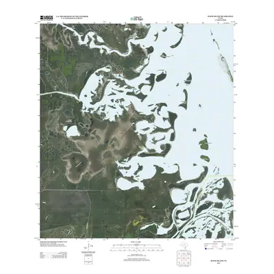
2013 Map of Hawk Island
USGS Topo · Published 2013About this map
The coastal marshlands and tidal flats of Cameron County are defined by a complex network of island landforms and low-lying elevations. Hawk Island and Josephine Island sit amidst a fragmented shoreline where the distinction between land and water shift with the tides. The presence of La Oveja Well indicates a history of resource extraction or agricultural necessity in this salt-influenced landscape. Further north, Chubby Island and Mullet Island emerge from the shallow flats, while Goose Hill and Green Hill provide modest topographic relief in an otherwise low coastal plane. The lone terrestrial corridor, Old Alice Rd, edges the southwestern corner of the quadrangle, serving as a primary link through this maritime environment.
Find a feature on this map
9 named features on this map. Tap any name to fly to it.
Don’t see what you’re looking for? This feature index may not catch every label — zoom into the map to look around manually.
Map Details
Editions of this 2013 Hawk Island Map
This is the sole edition of this map. No revisions or reprints were ever made.
Other maps of this area

1921 · Tarida Ranch
USGS Topo · 1:62,500

1929 · Buena Vista
USGS Topo · 1:24,000

1930 · La Leona
USGS Topo · 1:24,000

1933 · Paso Real
USGS Topo · 1:31,680

1935 · Buena Vista
USGS Topo · 1:31,680

1936 · La Leona
USGS Topo · 1:31,680

1952 · Green Island
USGS Topo · 1:24,000

1952 · South of Potrero Lopeno SE
USGS Topo · 1:24,000

1952 · Hawk Island
USGS Topo · 1:24,000

1952 · Port Mansfield
USGS Topo · 1:24,000