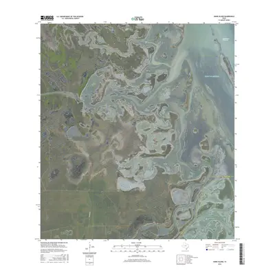
2016 Map of Hawk Island
USGS Topo · Published 2016About this map
Hawk Island and a series of low-lying landforms define this coastal stretch of the South Texas shoreline where the Gulf of Mexico meets the wetlands of the Rio Grande Valley. The landscape is a complex network of marshes and tidal flats, intersected by the engineered Intracoastal Waterway and the outlet of the North Floodway. The terrain is characterized by modest elevations such as Green Hill and Goose Hill, which stand out against the surrounding saturated environment. This 2016 survey captures the area's transition from open water to the mainland, showing the paths of named islands like Josephine Island and Chubby Island. To the south, Old Alice Rd provides one of the few named overland routes through this hydrologically active zone, following the boundary line between Willacy and Cameron counties.
Find a feature on this map
12 named features on this map. Tap any name to fly to it.
Don’t see what you’re looking for? This feature index may not catch every label — zoom into the map to look around manually.
Map Details
Editions of this 2016 Hawk Island Map
This is the sole edition of this map. No revisions or reprints were ever made.
Other maps of this area

1921 · Tarida Ranch
USGS Topo · 1:62,500

1929 · Buena Vista
USGS Topo · 1:24,000

1930 · La Leona
USGS Topo · 1:24,000

1933 · Paso Real
USGS Topo · 1:31,680

1935 · Buena Vista
USGS Topo · 1:31,680

1936 · La Leona
USGS Topo · 1:31,680

1952 · Green Island
USGS Topo · 1:24,000

1952 · South of Potrero Lopeno SE
USGS Topo · 1:24,000

1952 · Hawk Island
USGS Topo · 1:24,000

1952 · Port Mansfield
USGS Topo · 1:24,000