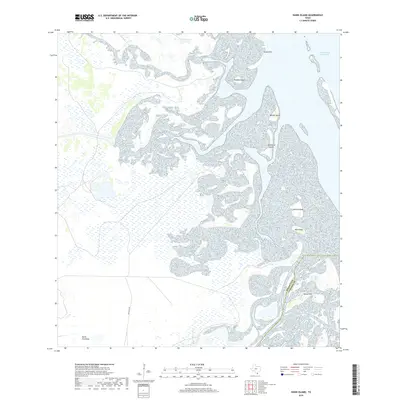
2019 Map of Hawk Island
USGS Topo · Published 2019About this map
The coastal wetlands and marshy expanses of the South Texas coast define this 2019 survey, where the Intracoastal Waterway cuts through the shallow waters of the Laguna Madre. The landscape is a complex network of low-lying terrain and island features, including Hawk Island, Chubby Island, and Mullet Island. This region, near the Willacy Co Cameron Co line, illustrates the environmental infrastructure of the Rio Grande Valley, specifically through the North Floodway designed for regional drainage. While much of the area is dominated by water and tidal flats, legacy infrastructure like Old Alice Rd hints at historic overland routes through these coastal reaches. These named rises, such as Green Hill and Goose Hill, provide sparse elevation within an otherwise saturated environment.
Find a feature on this map
11 named features on this map. Tap any name to fly to it.
Don’t see what you’re looking for? This feature index may not catch every label — zoom into the map to look around manually.
Map Details
Editions of this 2019 Hawk Island Map
This is the sole edition of this map. No revisions or reprints were ever made.
Other maps of this area

1921 · Tarida Ranch
USGS Topo · 1:62,500

1929 · Buena Vista
USGS Topo · 1:24,000

1930 · La Leona
USGS Topo · 1:24,000

1933 · Paso Real
USGS Topo · 1:31,680

1935 · Buena Vista
USGS Topo · 1:31,680

1936 · La Leona
USGS Topo · 1:31,680

1952 · Green Island
USGS Topo · 1:24,000

1952 · South of Potrero Lopeno SE
USGS Topo · 1:24,000

1952 · Hawk Island
USGS Topo · 1:24,000

1952 · Port Mansfield
USGS Topo · 1:24,000