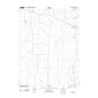
2012 Map of Hawk Point
USGS Topo · Published 2012About this map
Hawk Point and New Truxton anchor this landscape, where early settlement patterns are clearly visible through a dense concentration of local burial grounds. Family and community heritage is preserved in sites such as Anson Cemetery, Owings-Pennington Cemetery, and the Zion Cemetery near German Church Rd. The geography is defined by a network of small waterways, including Turkey Creek, Camp Creek, and Rock Branch, which drain the prairie lands toward Lake Warrenton in the southeast. In addition to the town centers, the map documents the Yeater Prairie area and numerous named farm roads like Turkey Creek Farm Ln and Hank Farms Ln, illustrating the enduring agricultural character of Lincoln County. Notable landmarks such as Cannon Spring and Starkey Hollow provide further context for the local terrain and early water sources.
Find a feature on this map
72 named features on this map. Tap any name to fly to it.
Don’t see what you’re looking for? This feature index may not catch every label — zoom into the map to look around manually.
Map Details
Editions of this 2012 Hawk Point Map
This is the sole edition of this map. No revisions or reprints were ever made.
Other maps of this area

1890 · Louisiana
USGS Topo · 1:125,000

1890 · Hermann
USGS Topo · 1:125,000

1937 · Silex
USGS Topo · 1:62,500

1939 · Silex
USGS Topo · 1:48,000

1942 · New Florence
USGS Topo · 1:62,500

1942 · Bellflower
USGS Topo · 1:62,500

1943 · Warrenton
USGS Topo · 1:62,500

1945 · Bellflower
USGS Topo · 1:62,500

1945 · Warrenton
USGS Topo · 1:62,500

1946 · New Florence
USGS Topo · 1:62,500