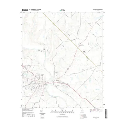
2014 Map of Hawkinsville
USGS Topo · Published 2014About this map
The Ocmulgee River anchors this central Georgia landscape, bisecting the region as it flows past the county seat of Hawkinsville. On the eastern bank, the smaller settlement of Hartford sits at a critical junction of routes including Us-129-Alt and the Eastman Hwy. The river's influence on the local topography is evident in the elevation at Taylors Bluff and Prichards Bluff, while the crossing is marked by the Roger H Lawson Memorial Bridge.
Find a feature on this map
137 named features on this map. Tap any name to fly to it.
Don’t see what you’re looking for? This feature index may not catch every label — zoom into the map to look around manually.
Map Details
Editions of this 2014 Hawkinsville Map
This is the sole edition of this map. No revisions or reprints were ever made.
Other maps of this area

1956 · Cochran
USGS Topo · 1:62,500

1956 · Perry
USGS Topo · 1:62,500

1957 · Macon
USGS Topo · 1:250,000

1958 · Macon
USGS Topo · 1:250,000

1964 · Macon
USGS Topo · 1:250,000

1972 · Finleyson East
USGS Topo · 1:24,000

1972 · West Of Eastman
USGS Topo · 1:24,000

1972 · Finleyson West
USGS Topo · 1:24,000

1973 · Hayneville
USGS Topo · 1:24,000

1973 · Klondike
USGS Topo · 1:24,000