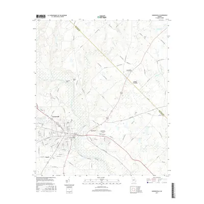
2017 Map of Hawkinsville
USGS Topo · Published 2017About this map
The Ocmulgee River serves as the central artery for this Georgia landscape, dividing the city of Hawkinsville on the western bank from the settlement of Hartford to the east. Connected by the Roger H Lawson Memorial Bridge, these two communities serve as the primary hubs for a region defined by agricultural river-bottom land and dense networks of local routes like Old Milledgeville Rd and Pulaski Cannon Rd. The survey reveals a high concentration of local family history markers, including Orange Hill Cem and Simpson Cem.
Find a feature on this map
119 named features on this map. Tap any name to fly to it.
Don’t see what you’re looking for? This feature index may not catch every label — zoom into the map to look around manually.
Map Details
Editions of this 2017 Hawkinsville Map
This is the sole edition of this map. No revisions or reprints were ever made.
Other maps of this area

1956 · Cochran
USGS Topo · 1:62,500

1956 · Perry
USGS Topo · 1:62,500

1957 · Macon
USGS Topo · 1:250,000

1958 · Macon
USGS Topo · 1:250,000

1964 · Macon
USGS Topo · 1:250,000

1972 · Finleyson East
USGS Topo · 1:24,000

1972 · West Of Eastman
USGS Topo · 1:24,000

1972 · Finleyson West
USGS Topo · 1:24,000

1973 · Hayneville
USGS Topo · 1:24,000

1973 · Klondike
USGS Topo · 1:24,000