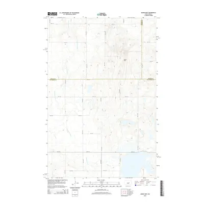
2014 Map of Hawks Nest
USGS Topo · Published 2014About this map
Hawks Nest rises as a prominent topographical landmark above the surrounding prairie, anchoring a landscape defined by the intersection of three North Dakota counties. This 2014 survey documents the rural section lines of Stutsman, Wells, and Foster counties, where the land is partitioned by a strict grid of gravel roads like 6th St SE and 55th Ave SE. The drainage of Little Pipestem Cr meanders across the western half of the map, carving a subtle path through the glacial terrain. The map captures a quintessential Great Plains vista of intermittent wetlands and high-plateau rises, reflecting the enduring agricultural layout of the region. Researchers can trace the exact county boundaries where Wells meets Foster and Stutsman counties, providing a precise record of the local political and natural geography.
Find a feature on this map
21 named features on this map. Tap any name to fly to it.
Don’t see what you’re looking for? This feature index may not catch every label — zoom into the map to look around manually.
Map Details
Editions of this 2014 Hawks Nest Map
This is the sole edition of this map. No revisions or reprints were ever made.
Other maps of this area

1948 · Carrington
USGS Topo · 1:62,500

1950 · Carrington SW
USGS Topo · 1:24,000

1950 · Carrington West
USGS Topo · 1:24,000

1951 · Dover
USGS Topo · 1:24,000

1951 · Sykeston
USGS Topo · 1:24,000

1952 · New Rockford
USGS Topo · 1:250,000

1956 · New Rockford
USGS Topo · 1:250,000

1958 · Goldwin
USGS Topo · 1:24,000

1971 · New Rockford
USGS Topo · 1:250,000

1972 · Woodworth
USGS Topo · 1:24,000