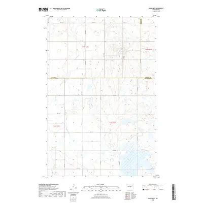
2018 Map of Hawks Nest
USGS Topo · Published 2018About this map
Hawks Nest rises as a prominent landmark in this prairie landscape, situated near the intersection of three North Dakota counties. The high ground provides a vantage point over the winding Little Pipestem Cr, which drains south through a terrain marked by numerous small wetlands and prairie potholes. This 2018 survey captures the area at a point where the administrative boundaries of Wells, Foster, and Stutsman counties meet. The land is organized by a strict section-line road grid, including 3rd St SE and 60th Ave SE, reflecting the enduring influence of the Public Land Survey System on the regional geography. This map is particularly useful for understanding the modern hydraulic patterns of the Pipestem watershed in relation to the longstanding township and range divisions.
Find a feature on this map
22 named features on this map. Tap any name to fly to it.
Don’t see what you’re looking for? This feature index may not catch every label — zoom into the map to look around manually.
Map Details
Editions of this 2018 Hawks Nest Map
This is the sole edition of this map. No revisions or reprints were ever made.
Other maps of this area

1948 · Carrington
USGS Topo · 1:62,500

1950 · Carrington SW
USGS Topo · 1:24,000

1950 · Carrington West
USGS Topo · 1:24,000

1951 · Dover
USGS Topo · 1:24,000

1951 · Sykeston
USGS Topo · 1:24,000

1952 · New Rockford
USGS Topo · 1:250,000

1956 · New Rockford
USGS Topo · 1:250,000

1958 · Goldwin
USGS Topo · 1:24,000

1971 · New Rockford
USGS Topo · 1:250,000

1972 · Woodworth
USGS Topo · 1:24,000