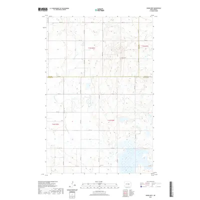
2020 Map of Hawks Nest
USGS Topo · Published 2020About this map
Hawks Nest, a prominent high point in this prairie landscape, anchors the northeastern portion of a terrain defined by glacial depressions and seasonal wetlands. Situated at the junction where Wells, Foster, and Stutsman counties meet, the area reflects the rigid section-line organization of North Dakota's agricultural heartland. A network of rural routes, including 3rd St SE and 11th St SE, provides access to the scattered homesteads and fields that characterize this region. Historically significant for local families, the Lunde Cem sits quietly in the southern portion of the quadrangle. The wandering course of Little Pipestem Cr cuts through the western sections, its drainage pattern influencing the placement of local roads and property boundaries. This landscape is a classic example of Northern Great Plains topography, where the natural water flow of the creek and the artificial grid of the township system coexist.
Find a feature on this map
18 named features on this map. Tap any name to fly to it.
Don’t see what you’re looking for? This feature index may not catch every label — zoom into the map to look around manually.
Map Details
Editions of this 2020 Hawks Nest Map
This is the sole edition of this map. No revisions or reprints were ever made.
Other maps of this area

1948 · Carrington
USGS Topo · 1:62,500

1950 · Carrington SW
USGS Topo · 1:24,000

1950 · Carrington West
USGS Topo · 1:24,000

1951 · Dover
USGS Topo · 1:24,000

1951 · Sykeston
USGS Topo · 1:24,000

1952 · New Rockford
USGS Topo · 1:250,000

1956 · New Rockford
USGS Topo · 1:250,000

1958 · Goldwin
USGS Topo · 1:24,000

1971 · New Rockford
USGS Topo · 1:250,000

1972 · Woodworth
USGS Topo · 1:24,000