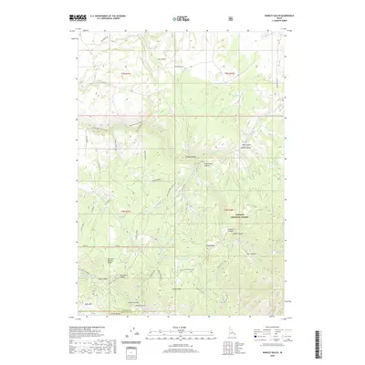
2020 Map of Hawley Gulch
USGS Topo · Published 2020About this map
Targhee National Forest defines the eastern expanse of this Idaho landscape, where high ridges and deep drainages form a complex topography. The map illustrates a developed water management system through features like the Upper Waterfall Canal and Lower Waterfall Canal, supporting the local geography near the settlement of Batman. Historical resource extraction is evidenced by the Morning Glory Mine situated near the head of Wolverine / Hawley Gulch. Significant elevation is found at Lookout Mountain and Kelly Mtn, while the terrain is deeply incised by Limekiln Canyon, Spooky Canyon, and Sawmill Gulch. This 2020 survey details a network of forest roads and trails, including the Cabin Climb Trail and Best Of Moody, providing a clear record of modern access across the Madison and Bonneville County line.
Find a feature on this map
49 named features on this map. Tap any name to fly to it.
Don’t see what you’re looking for? This feature index may not catch every label — zoom into the map to look around manually.
Map Details
Editions of this 2020 Hawley Gulch Map
This is the sole edition of this map. No revisions or reprints were ever made.
Other maps of this area

1943 · Garns Mtn
USGS Topo · 1:62,500

1946 · Garns Mtn
USGS Topo · 1:62,500

1951 · Moody
USGS Topo · 1:24,000

1951 · Poplar
USGS Topo · 1:24,000

1951 · Hawley Gulch
USGS Topo · 1:24,000

1951 · Heise
USGS Topo · 1:24,000

1951 · Heise SE
USGS Topo · 1:24,000

1951 · White Owl Butte
USGS Topo · 1:24,000

1955 · Driggs
USGS Topo · 1:250,000

1958 · Driggs
USGS Topo · 1:250,000