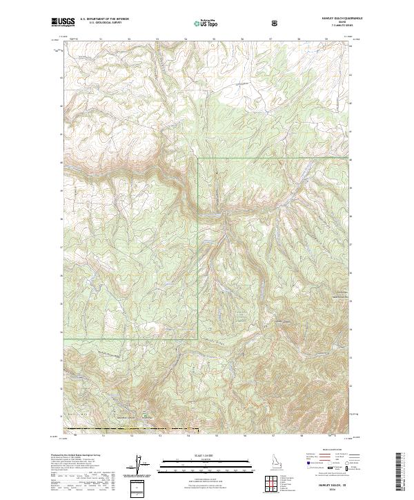
2024 Map of Hawley Gulch
USGS Topo · Published 2024About this map
The Targhee National Forest dominates this landscape, where the rugged topography of eastern Idaho is defined by a series of deep drainages and prominent peaks. High points like Farnes Mtn and West Farnes Mtn overlook a complex system of gulches and canyons, including the namesake Hawley Gulch and the narrow Sawmill Gulch. The map reveals an intricate network of forest access routes such as South State Trl and the Wolverine/Hawley Gulch Trail, which navigate the steep elevations between Windy Ridge and the Buckskin Morgan Ridge. Drainage patterns are clearly marked by Moody Creek and its branches, while the presence of named springs like Mud Springs and Hawley Spring highlights the vital water sources in this high-altitude terrain. The southern portion of the map transitions into the steep walls of Kelly Canyon and the broad expanse of Poison Flat, illustrating the diverse geological formations at the border of Madison and Bonneville counties.
Find a feature on this map
48 named features on this map. Tap any name to fly to it.
Don’t see what you’re looking for? This feature index may not catch every label — zoom into the map to look around manually.
Map Details
Editions of this 2024 Hawley Gulch Map
This is the sole edition of this map. No revisions or reprints were ever made.
Other maps of this area

1943 · Garns Mtn
USGS Topo · 1:62,500

1946 · Garns Mtn
USGS Topo · 1:62,500

1951 · Moody
USGS Topo · 1:24,000

1951 · Poplar
USGS Topo · 1:24,000

1951 · Hawley Gulch
USGS Topo · 1:24,000

1951 · Heise
USGS Topo · 1:24,000

1951 · Heise SE
USGS Topo · 1:24,000

1951 · White Owl Butte
USGS Topo · 1:24,000

1955 · Driggs
USGS Topo · 1:250,000

1958 · Driggs
USGS Topo · 1:250,000