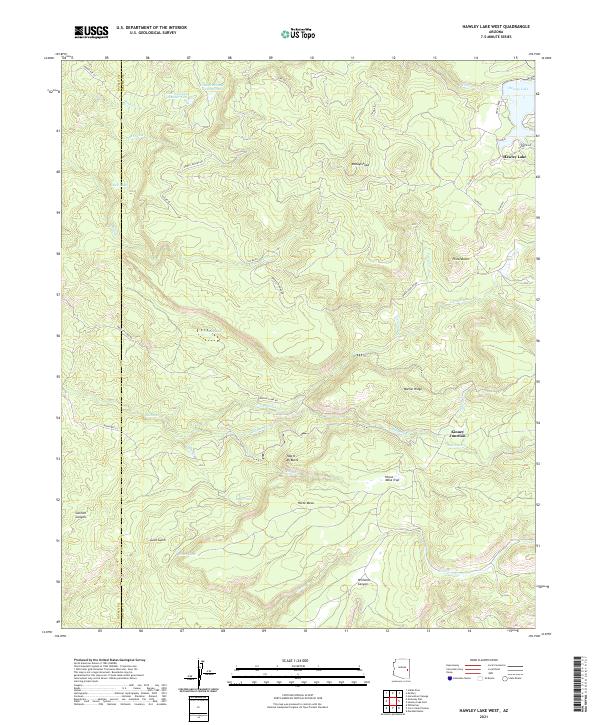
2021 Map of Hawley Lake West
USGS Topo · Published 2021About this map
The high-elevation terrain of the White Mountains is defined by complex hydrology and rugged peaks in this modern survey. Water management for livestock and recreation is prominent, evidenced by the series of reservoirs and tanks including Lone Pine Tank Number One, Lone Pine Tank Number Two, and Woolsey Lake. The landscape is carved by numerous drainages such as Bear Flat Cr and Little Diamond Cr, which flow through deep landforms like Goklish Canyon and Williams Canyon.
Find a feature on this map
54 named features on this map. Tap any name to fly to it.
Don’t see what you’re looking for? This feature index may not catch every label — zoom into the map to look around manually.
Map Details
Editions of this 2021 Hawley Lake West Map
This is the sole edition of this map. No revisions or reprints were ever made.
Other maps of this area

1886 · St Johns
USGS Topo · 1:250,000

1892 · St Johns
USGS Topo · 1:250,000

1954 · Clifton
USGS Topo · 1:250,000

1954 · Saint Johns
USGS Topo · 1:250,000

1957 · Clifton
USGS Topo · 1:250,000

1957 · Saint Johns
USGS Topo · 1:250,000

1958 · Clifton
USGS Topo · 1:250,000

1958 · Saint Johns
USGS Topo · 1:250,000

1961 · McNary
USGS Topo · 1:62,500

1962 · Clifton
USGS Topo · 1:250,000