
1966 Map of Hawley
USGS Topo · Published 1969About this map
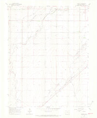
The Atchison Topeka and Santa Fe railroad corridor anchors this agricultural region in Otero County, where life followed the movement of water and rail in the mid-1960s. Small community centers like Hawley and Roberta are mapped alongside the Grand Valley Sch, reflecting a rural settlement pattern supported by an extensive irrigation network. The landscape is defined by the Highline Canal, Otero Canal, and Catlin Canal, which cut across the natural drainages of Timpas Creek and Crooked Arroyo. This complex water management system allowed for farming in an otherwise arid environment. Of particular historical note is the alignment of the Santa Fe Trail, which parallels the modern railroad and the settlement at Benton, tracing the path of one of America's most significant westward migration routes.
Find a feature on this map
18 named features on this map. Tap any name to fly to it.
Don’t see what you’re looking for? This feature index may not catch every label — zoom into the map to look around manually.
Map Details
Editions of this 1966 Hawley Map
4 editions found
Other maps of this area

1891 · Catlin
USGS Topo · 1:125,000

1891 · Timpas
USGS Topo · 1:125,000

1893 · Catlin
USGS Topo · 1:125,000

1894 · Timpas
USGS Topo · 1:125,000

1953 · Cheraw
USGS Topo · 1:24,000

1954 · Manzanola
USGS Topo · 1:24,000

1954 · Lamar
USGS Topo · 1:250,000

1955 · Rocky Ford
USGS Topo · 1:24,000

1955 · La Junta
USGS Topo · 1:250,000

1958 · La Junta
USGS Topo · 1:250,000