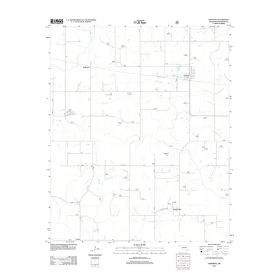
2012 Map of Haworth
USGS Topo · Published 2012About this map
Haworth serves as the central hub for this corner of McCurtain County, where the landscape is defined by the winding paths of Norwood Cr and Goodwater Cr. The settlement pattern reflects deep community roots, anchored by the Thomas Chapel Cem and Haworth Cem, while the industrial and agricultural nature of the area is highlighted by structures like the Tiak Lookout Tower and Haworth Tower. To the south and west, the smaller communities of Pleasant Hill, Harris, and Kullituklo are linked by a network of rural routes including Pollard Rd and Pleasant Hill Rd. The map documents a terrain bisected by numerous waterways, with Push Cr, Mud Cr, and Holly Br draining the timber and farmland that characterize the region's topography.
Find a feature on this map
16 named features on this map. Tap any name to fly to it.
Don’t see what you’re looking for? This feature index may not catch every label — zoom into the map to look around manually.
Map Details
Editions of this 2012 Haworth Map
This is the sole edition of this map. No revisions or reprints were ever made.
Other maps of this area

1950 · Idabel
USGS Topo · 1:24,000

1950 · De Kalb NW
USGS Topo · 1:24,000

1950 · Shults
USGS Topo · 1:24,000

1950 · Haworth
USGS Topo · 1:24,000

1950 · Tom
USGS Topo · 1:24,000

1950 · Goodwater
USGS Topo · 1:24,000

1950 · Bokhoma
USGS Topo · 1:24,000

1951 · Idabel
USGS Topo · 1:24,000

1951 · Idabel SE
USGS Topo · 1:24,000

1951 · English
USGS Topo · 1:24,000