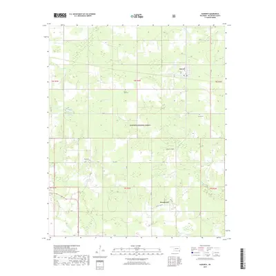
2019 Map of Haworth
USGS Topo · Published 2019About this map
Haworth and the nearby community of Pleasant Hill are central to this landscape in southeastern McCurtain County. The terrain is characterized by a dense network of watercourses, including Mud Cr, Norwood Cr, and Push Cr, which weave through the southern portion of the Ouachita National Forest. Several local burial grounds, such as Thomas Chapel Cem, Haworth Cem, and Pollard Cem, provide essential landmarks for genealogists and local historians tracking family roots in this rural timber and agricultural region. The inclusion of the Haworth Tower and infrastructure like Oak St and Pollard Rd illustrates the modern development pattern within the traditional forest boundaries. Two significant water bodies, 089017 Reservoir and 089007 Reservoir, dominate the western landscape, indicating managed water resources near the Grassy Slough and Red Slough wetlands.
Find a feature on this map
25 named features on this map. Tap any name to fly to it.
Don’t see what you’re looking for? This feature index may not catch every label — zoom into the map to look around manually.
Map Details
Editions of this 2019 Haworth Map
This is the sole edition of this map. No revisions or reprints were ever made.
Other maps of this area

1950 · Idabel
USGS Topo · 1:24,000

1950 · De Kalb NW
USGS Topo · 1:24,000

1950 · Shults
USGS Topo · 1:24,000

1950 · Haworth
USGS Topo · 1:24,000

1950 · Tom
USGS Topo · 1:24,000

1950 · Goodwater
USGS Topo · 1:24,000

1950 · Bokhoma
USGS Topo · 1:24,000

1951 · Idabel
USGS Topo · 1:24,000

1951 · Idabel SE
USGS Topo · 1:24,000

1951 · English
USGS Topo · 1:24,000