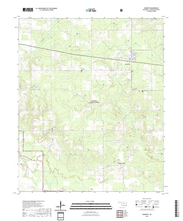
2022 Map of Haworth
USGS Topo · Published 2022About this map
Haworth serves as a central hub in this corner of McCurtain County, where local roads like Stiles St and Cassie St define the settlement's layout. To the south, the landscape shifts into the timberlands of the Ouachita National Forest, a terrain marked by an intricate network of waterways including Norwood Creek and Push Creek. For local history researchers, this map documents several small community centers and burial sites, including Pleasant Hill and Harris, alongside the Thomas Chapel Cem and Pollard Cem. The southern reach of the survey is characterized by the low-lying wetlands of Red Slough and Grassy Slough, illustrating the transition from upland forest to the bottomlands near the state border. Small-scale water management is evident through features like the 089007 Reservoir and 089017 Reservoir, which dot the drainage basins of Holly Branch and Mud Creek.
Find a feature on this map
28 named features on this map. Tap any name to fly to it.
Don’t see what you’re looking for? This feature index may not catch every label — zoom into the map to look around manually.
Map Details
Editions of this 2022 Haworth Map
This is the sole edition of this map. No revisions or reprints were ever made.
Other maps of this area

1950 · Idabel
USGS Topo · 1:24,000

1950 · De Kalb NW
USGS Topo · 1:24,000

1950 · Shults
USGS Topo · 1:24,000

1950 · Haworth
USGS Topo · 1:24,000

1950 · Tom
USGS Topo · 1:24,000

1950 · Goodwater
USGS Topo · 1:24,000

1950 · Bokhoma
USGS Topo · 1:24,000

1951 · Idabel
USGS Topo · 1:24,000

1951 · Idabel SE
USGS Topo · 1:24,000

1951 · English
USGS Topo · 1:24,000