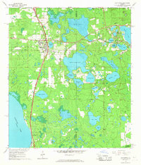
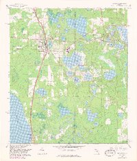
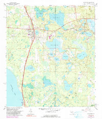
1966 Map of Hawthorne
USGS Topo · Published 1967About this map
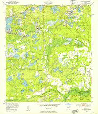
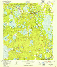
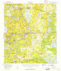
Hawthorne serves as a central junction where the Seaboard Coast Line railroad routes converge, anchoring a landscape defined by North Florida’s complex hydrologic network. The settlement pattern is closely tied to the water, with the town site positioned between Johnson Lake and the vast marshes of Little Orange Lake. Further east, the small community of McMeekin sits nestled among a cluster of smaller water bodies including Lak-a-wana Lake and North Twin Lake.
Find a feature on this map
43 named features on this map. Tap any name to fly to it.
Don’t see what you’re looking for? This feature index may not catch every label — zoom into the map to look around manually.
Map Details
Editions of this 1966 Hawthorne Map
3 editions found
Other maps of this area

1893 · Citra
USGS Topo · 1:62,500

1895 · Citra
USGS Topo · 1:62,500

1915 · Interlachen
USGS Topo · 1:48,000

1916 · Interlachen
USGS Topo · 1:62,500

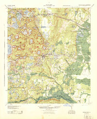
1938 · Hawthorn
USGS Topo · 1:48,000

1943 · Hawthorn
USGS Topo · 1:62,500
1944 · Interlachen
USGS Topo · 1:62,500
1949 · Keuka
USGS Topo · 1:24,000
1949 · Putnam Hall
USGS Topo · 1:24,000
1949 · Interlachen
USGS Topo · 1:62,500