1966 Map of Hawthorne
USGS Topo · Published 1990About this map
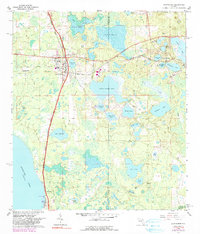
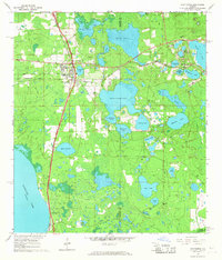
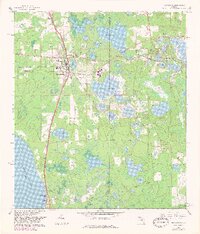
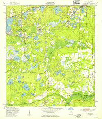
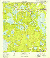
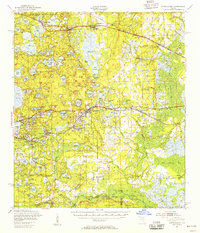
Hawthorne serves as the primary hub of this North Florida landscape, situated at the junction of two major rail corridors. The Seaboard Coast Line cuts through the region, connecting the residential grid near West Lake Street with the more rural reaches to the east. The terrain is defined by a dense network of lakes and prairies, including the expansive Little Orange Lake and the marshy Fowlers Prairie. Smaller settlements like McMeekin and Lochloosa are established along the water, where landmarks like the Lochloosa Lake Park boat ramp point to the importance of the lakefront for local recreation. Genealogists will find notable sites such as Gordon Cem and Drummond Cem, alongside rural houses of worship like Gilgal Ch and Gordon Chapel. The presence of a Claypit near Bream Lake indicates the area's small-scale industrial activity during the mid-1960s.
Find a feature on this map
44 named features on this map. Tap any name to fly to it.
Don’t see what you’re looking for? This feature index may not catch every label — zoom into the map to look around manually.
Map Details
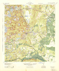
Editions of this 1966 Hawthorne Map
3 editions found
Other maps of this area

1893 · Citra
USGS Topo · 1:62,500

1895 · Citra
USGS Topo · 1:62,500

1915 · Interlachen
USGS Topo · 1:48,000

1916 · Interlachen
USGS Topo · 1:62,500

1938 · Hawthorn
USGS Topo · 1:48,000

1943 · Hawthorn
USGS Topo · 1:62,500
1944 · Interlachen
USGS Topo · 1:62,500
1949 · Keuka
USGS Topo · 1:24,000
1949 · Putnam Hall
USGS Topo · 1:24,000
1949 · Interlachen
USGS Topo · 1:62,500