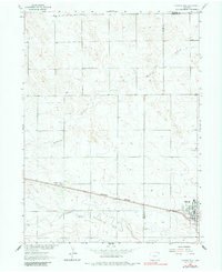
1962 Map of Haxtun West
USGS Topo · Published 1983About this map
Haxtun and Dailey anchor this high-plains landscape in the early 1960s, showing a region defined by agricultural surveying and emerging energy extraction. The Burlington Northern railroad cuts a straight line through the southern half of the sheet, providing the primary transport artery for the small grain-handling and residential centers. In the west, the Dailey Oil Field is marked by numerous gas wells and drill holes, illustrating the industrial expansion occurring alongside traditional ranching. Natural drainage is dictated by the ephemeral paths of Wildhorse Creek and the North Fork Frenchman Creek, which carve subtle topography into the prairie. Local civic life is concentrated on the eastern edge at Haxtun, where a High Sch, Cemetery, and residential grid including Strohm St suggest a stable community at the edge of Phillips County.
Find a feature on this map
16 named features on this map. Tap any name to fly to it.
Don’t see what you’re looking for? This feature index may not catch every label — zoom into the map to look around manually.
Map Details
Editions of this 1962 Haxtun West Map
2 editions found
Other maps of this area

1952 · Marks Butte
USGS Topo · 1:24,000

1953 · Tamarack Ranch
USGS Topo · 1:24,000

1953 · Crook
USGS Topo · 1:24,000

1954 · Sterling
USGS Topo · 1:250,000

1958 · Sterling
USGS Topo · 1:250,000

1962 · Fleming
USGS Topo · 1:24,000

1962 · Haxtun East
USGS Topo · 1:24,000

1962 · Haxtun West
USGS Topo · 1:24,000

1971 · Haxtun SE
USGS Topo · 1:24,000

1972 · St Petersburg
USGS Topo · 1:24,000