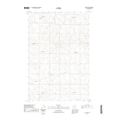
2020 Map of Hay Coulee
USGS Topo · Published 2020About this map
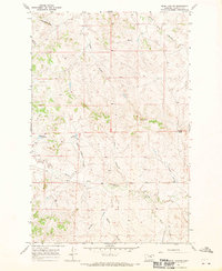
Square Butte rises above the drainage networks of Garfield County, marking a prominent natural landmark in this section of central Montana. The landscape is defined by its deep coulees and seasonal creek forks, reflecting the arid character of the region's topography. Hay Coulee and Cottonwood Coulee carve through the terrain, while water courses like the Dry Fork Nancy Russell Cr and N Fork Lodgepole Cr suggest a complex watershed system. Human presence is sparse, dictated by the remote geography and represented primarily by N Lodge Pole Rd, which provides the primary access through these townships. The detailed contour lines and drainage patterns, including the path of Union Cr, highlight the erosion-carved plateaus typical of this prairie environment.
Find a feature on this map
14 named features on this map. Tap any name to fly to it.
Don’t see what you’re looking for? This feature index may not catch every label — zoom into the map to look around manually.
Map Details
Editions of this 2020 Hay Coulee Map
This is the sole edition of this map. No revisions or reprints were ever made.
Other maps of this area

1954 · Jordan
USGS Topo · 1:250,000

1956 · Jordan
USGS Topo · 1:250,000

1958 · Jordan
USGS Topo · 1:250,000

1964 · Jordan
USGS Topo · 1:250,000

1965 · Spring Creek School
USGS Topo · 1:24,000

1965 · Cap Rock Butte
USGS Topo · 1:24,000
1965 · Twin Buttes
USGS Topo · 1:24,000
1967 · Coffin Butte
USGS Topo · 1:24,000
1967 · Hay Coulee
USGS Topo · 1:24,000
1967 · Searl Coulee
USGS Topo · 1:24,000