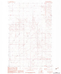
1983 Map of Hay Creek
USGS Topo · Published 1983About this map
The Fort Peck Indian Reservation landscape is defined by the intermittent drainages of the Missouri River plateau as documented in this 1983 provisional survey. Hay Creek runs through the central and southern portions of the quadrangle, serving as a primary drainage corridor for the high prairie. The map details a network of deeply etched coulees typical of the northern Great Plains, including Swank Coulee and Kirns Coulee. These features represent the essential topography for local land use, showing how water movement has shaped the benchlands and provided natural pathways through the Roosevelt County interior. Compiled from 1975 aerial photography, the sheet records the remote character of this reservation land during a period of minimal structural development, focusing instead on the complex relief and elevation changes of the high plains.
Find a feature on this map
6 named features on this map. Tap any name to fly to it.
Don’t see what you’re looking for? This feature index may not catch every label — zoom into the map to look around manually.
Map Details
Editions of this 1983 Hay Creek Map
This is the sole edition of this map. No revisions or reprints were ever made.
Other maps of this area

1909 · Smoke Creek
USGS Topo · 1:62,500

1912 · Hay Creek
USGS Topo · 1:62,500

1912 · Smoke Creek
USGS Topo · 1:62,500

1954 · Wolf Point
USGS Topo · 1:250,000

1958 · Wolf Point
USGS Topo · 1:250,000

1973 · Pleasant Prairie
USGS Topo · 1:24,000

1973 · Pleasant Prairie SW
USGS Topo · 1:24,000

1982 · Culbertson
USGS Topo · 1:100,000
1983 · Hay Creek NW
USGS Topo · 1:24,000
1983 · Smoke Creek SW
USGS Topo · 1:24,000