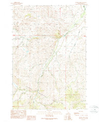
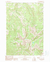
1989 Map of Hayden Creek
USGS Topo · Published 1989About this map
The Salmon National Forest dominates this Idaho landscape, where high mountain drainage systems converge into the Lemhi River valley. A historic Indian Treaty Boundary cuts across the northern terrain, marking a significant legal and cultural line through the wilderness. The map documents an area defined by its water resources, including the central Hayden Creek and its many tributaries such as Meadow Creek and Little Sawmill Creek. Local industry and land use are evidenced by a specific Mine location and a Fish Hatchery situated along the lower reach of Hayden Creek near the valley floor. High-altitude features like Hayden Basin and Boulder Flat Creek illustrate the complex topography of the Lemhi Range, while named drainages like Rye Grass Creek and Bear Valley Creek suggest a history of seasonal grazing and wildlife movement within the national forest.
Find a feature on this map
24 named features on this map. Tap any name to fly to it.
Don’t see what you’re looking for? This feature index may not catch every label — zoom into the map to look around manually.
Map Details
Editions of this 1989 Hayden Creek Map
This is the sole edition of this map. No revisions or reprints were ever made.
Other maps of this area

1955 · Dubois
USGS Topo · 1:250,000

1956 · Patterson
USGS Topo · 1:62,500

1956 · May
USGS Topo · 1:62,500

1956 · Lemhi
USGS Topo · 1:62,500

1958 · Dubois
USGS Topo · 1:250,000
1962 · Lem Peak
USGS Topo · 1:24,000
1962 · Poison Peak
USGS Topo · 1:24,000

1980 · Leadore
USGS Topo · 1:100,000
1989 · Lemhi
USGS Topo · 1:24,000
1989 · Mogg Mountain
USGS Topo · 1:24,000