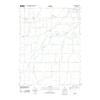
2010 Map of Hayden
USGS Topo · Published 2010About this map
The Vernon Fork Muscatatuck River winds through this rural landscape west of North Vernon, where a high density of family and community burial grounds provides significant historical depth for genealogists. The map identifies over ten distinct cemeteries, including Whitcomb Cemetery, Saint James Cemetery, and the German Cemetery, situated among a grid of county roads. Small settlements such as Hayden, Four Corners, and Lovett are connected by a network of creeks and branches that drain into the Muscatatuck, including Sixmile Creek and Tea Creek. The presence of the Van Voorhies Lake Dam at Tanglewood Lake illustrates more modern water management and recreation patterns alongside traditional agricultural land use in Jennings County.
Find a feature on this map
68 named features on this map. Tap any name to fly to it.
Don’t see what you’re looking for? This feature index may not catch every label — zoom into the map to look around manually.
Map Details
Editions of this 2010 Hayden Map
This is the sole edition of this map. No revisions or reprints were ever made.
Other maps of this area

1942 · Columbus
USGS Topo · 1:125,000

1953 · Cincinnati
USGS Topo · 1:250,000

1956 · Volga
USGS Topo · 1:24,000

1956 · Deputy
USGS Topo · 1:24,000

1956 · Louisville
USGS Topo · 1:250,000

1957 · Cincinnati
USGS Topo · 1:250,000

1957 · Butlerville
USGS Topo · 1:24,000

1957 · Azalia
USGS Topo · 1:24,000

1957 · North Vernon
USGS Topo · 1:24,000
1959 · Vernon
USGS Topo · 1:24,000