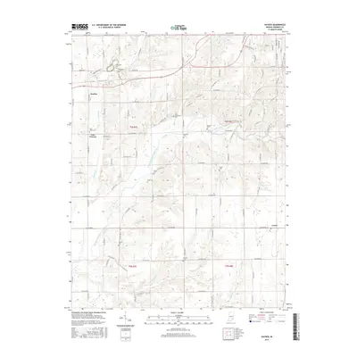
2016 Map of Hayden
USGS Topo · Published 2016About this map
The Vernon Fork Muscatatuck River meanders through this portion of Jennings County, anchoring a landscape defined by small rural settlements and a high density of early burial grounds. The community of Hayden sits in the northwest, while the small crossroads of Four Corners and the village of Lovett occupy the southern reaches. For genealogists, the map is remarkably dense with family and community markers, including the Saint Catherines Cem, Sixmile Cem, and the German Cem near the banks of Tea Creek. A network of drainage basins, including Indian Creek and Sixmile Creek, shapes the local topography, which is gridded by county roads like W Base Road. The presence of both the Blue Trail and Green Trail in the northeast corner suggests the integration of modern recreational paths into this traditional agricultural and riverine corridor.
Find a feature on this map
48 named features on this map. Tap any name to fly to it.
Don’t see what you’re looking for? This feature index may not catch every label — zoom into the map to look around manually.
Map Details
Editions of this 2016 Hayden Map
This is the sole edition of this map. No revisions or reprints were ever made.
Other maps of this area

1942 · Columbus
USGS Topo · 1:125,000

1953 · Cincinnati
USGS Topo · 1:250,000

1956 · Volga
USGS Topo · 1:24,000

1956 · Deputy
USGS Topo · 1:24,000

1956 · Louisville
USGS Topo · 1:250,000

1957 · Cincinnati
USGS Topo · 1:250,000

1957 · Butlerville
USGS Topo · 1:24,000

1957 · Azalia
USGS Topo · 1:24,000

1957 · North Vernon
USGS Topo · 1:24,000
1959 · Vernon
USGS Topo · 1:24,000