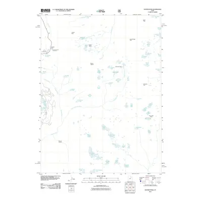
2011 Map of Hayden Peak
USGS Topo · Published 2011About this map
Hayden Peak and Mount Agassiz anchor this high-elevation survey of the Uinta Mountains during the early 21st century. The landscape is defined by its glacial hydrology, where the Stillwater Fork and Duchesne River begin their descent through deep alpine basins. A dense network of high-country water bodies, including Naturalist Basin and the Four Lakes Basin, illustrates the complex drainage patterns of the region. The map documents recreation infrastructure at Hayden Pass, featuring the Highline Trail Head Campground and Butterfly Campground along the winding mountain road. Researchers can trace the varied topography from Middle Basin to Rocky Sea Pass, witnessing the source waters of major river systems and the placement of remote landmarks like Amethyst Lake and Kermsuh Lake across the rocky terrain.
Find a feature on this map
70 named features on this map. Tap any name to fly to it.
Don’t see what you’re looking for? This feature index may not catch every label — zoom into the map to look around manually.
Map Details
Editions of this 2011 Hayden Peak Map
This is the sole edition of this map. No revisions or reprints were ever made.
Other maps of this area

1885 · Uinta
USGS Topo · 1:250,000

1901 · Hayden Peak
USGS Topo · 1:125,000

1903 · Hayden Peak
USGS Topo · 1:125,000

1954 · Salt Lake City
USGS Topo · 1:250,000

1958 · Salt Lake City
USGS Topo · 1:250,000

1960 · Salt Lake City
USGS Topo · 1:250,000

1967 · Explorer Peak
USGS Topo · 1:24,000
1967 · Tworoose Pass
USGS Topo · 1:24,000
1967 · Red Knob
USGS Topo · 1:24,000
1972 · Iron Mine Mountain
USGS Topo · 1:24,000