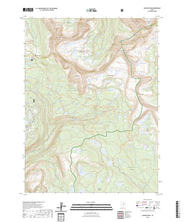
2023 Map of Hayden Peak
USGS Topo · Published 2023About this map
Hayden Peak and Mt Agassiz anchor this high-elevation wilderness landscape where the boundaries of the Wasatch National Forest and Ashley National Forest meet. The terrain is defined by a dense concentration of alpine lakes and basins, including Naturalist Basin, Amethyst Basin, and the Middle Basin. This 2023 survey illustrates the modern trail network that facilitates movement through the High Uintas Wilderness, featuring long-distance routes like the Uinta Highline Trl and the Hades-Rocky Sea Pass Trl. Notable landmarks such as Hayden Pass and Rocky Sea Pass mark the high points of these routes. The map also traces the headwaters of the Duchesne and Uinta rivers, which flow through Uinta Valley and Marsell Canyon, providing a detailed look at the drainage patterns and glaciated cirques of the Uinta Mountains.
Find a feature on this map
99 named features on this map. Tap any name to fly to it.
Don’t see what you’re looking for? This feature index may not catch every label — zoom into the map to look around manually.
Map Details
Editions of this 2023 Hayden Peak Map
This is the sole edition of this map. No revisions or reprints were ever made.
Other maps of this area

1885 · Uinta
USGS Topo · 1:250,000

1901 · Hayden Peak
USGS Topo · 1:125,000

1903 · Hayden Peak
USGS Topo · 1:125,000

1954 · Salt Lake City
USGS Topo · 1:250,000

1958 · Salt Lake City
USGS Topo · 1:250,000

1960 · Salt Lake City
USGS Topo · 1:250,000

1967 · Explorer Peak
USGS Topo · 1:24,000
1967 · Tworoose Pass
USGS Topo · 1:24,000
1967 · Red Knob
USGS Topo · 1:24,000
1972 · Iron Mine Mountain
USGS Topo · 1:24,000